
Objectives
& development
of the installations
Combinations
between sites make appear "routes";
these are the joints of our installations
D The work finds its first objective in the installations that we present. We propose combinations between sites, that is to say "routes" between various points of the globe. |
|
D A main theme leads to the selection of the combinated sites. Let's remember the previous exhibits : "Traces of Oblivion" and "Deserted Traces" or "Aquifers traces - the Memory of Water" - project in gestation. It would collect the "aqutic" sites of our inventory to produce a suggested route along the water cycle. |
 |
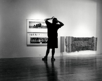
D "Cartographic lines" appear between the connected points and create a strange and magic relation in the space and in the time. The course of an exhibition can take shape of a triangulation (3 sites) in the space or, wider, of an open line. Cartographic views are produced to materialize these imaginary lines in the space; then appear geometric ratios. These are the "routes" that joint our installations. It reminds us the "song lines" that link the sacred sites of the Aboriginals of Australia. In 1996, we have intentionally followed the course of the 05°52'30"E meridian, defined like the "Meridian of Verviers", between its immersion in the Mediterranean and in the North Sea. This imaginary line went through the Fine Arts Museum of Verviers (Belgium) and linked the three sites of intervention - ("the
Meridian of Verviers" or the reading of the earth in
the contempory art; collective exhibition organized by
"Les Amis des Musées" de Verviers, September
and October 1996). |
|
| D In the
space of exhibition, the course goes from boundary to
boundary. That is how a "route" is maerialized.
The "boundary" reproduces a surrounding sound
detail recorded on site in combination with a
cartographic view or aerial picture of the zone. It
combines simultaneously two approaches: the space overfly
of a satellite and the touch of a microphone close to the
ground. The sounds of the course mix together; the
"sound line" shows the way to follow... |
|
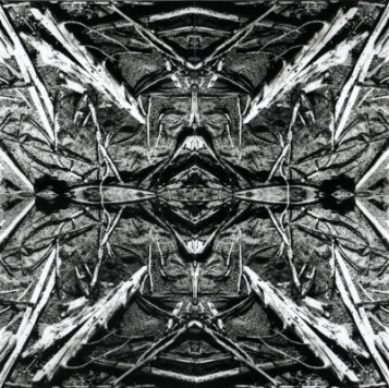
| D An
"Earth Fragment" is exhibited in front of each
boundary. These detail photographs of the ground material
are mounted following two perpendicular axis of symmetry.
Then the mounting gives a particular reading of the
earth's crust. |
 |
D The photographic lens has landed and sweeped the horizon. It depicts the site through its environment. The given informations of the GPS are added to the photos to constitue the "Panoramic Box". |
|
D The samples collected on site are joined to the color photographic details. They are carefully integrated in a glass box to constitue the "Sample Box". Here we enter specifically into the zone of intervention. We find out the signs of the past and imagine the course of life elapsed on the site. |
|
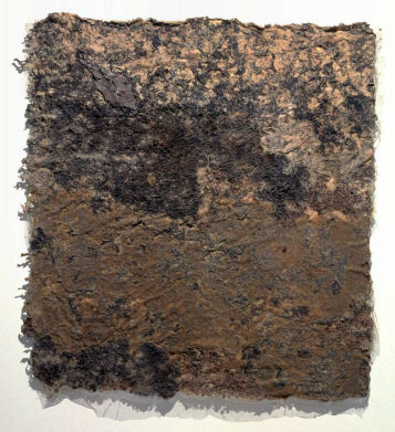
D The "Imprints" lead us deeply into the heard of the matter, in the depths of memory. There, an infinitesimal instant of life is frozen and is revealed to us. The course is once again disrupted... |
 |
D Each survey site is made up of: -silicone
imprint(s), various sizes; |
|
DThe pluridimensional images "bank" could give rise soon to a dynamic access with Internet. The procedure would permit to prepare a number of lectures on subjects such as regions, themes of special interest, fascinating objects, textures, sounds, ... A multitude of "routes" grouping and linking the sites would be offered. There are as many trails which can be traced around the world, as there are ways of travelling in the landscape... |
| Capter les Traces |
| Suivre les Routes | |||
| Routes Désertées |
Routes d'Eau |
Routes Minières et Industrielles |
Routes Egarées |